Visitor # since 22.DEC.2004
![]()
![]()
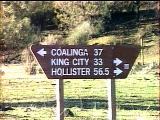
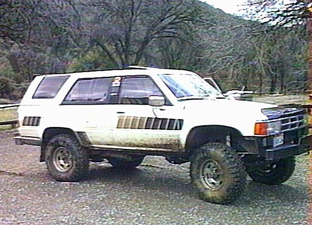
Located about an hour and a half south of Hollister, CA. on state highway 25, is the BLM Clear Creek Management Area. There are numerous trails in this rather large area, one of which is the famous Molina Ghost Run.
El Niño Update
This winter's storms have taken their toll on this OHV area. Before heading out to Clear Creek, it is a good idea to check the status of Hwy. 25 on the Cal-Trans web page and to call the BLM Clear Creek hotline at +1.408.630.5060. Latest report has it that the park was partially re-opened on 02/27/98. Apparently, there is access from the south via Coalinga and the west from King City. The north access via Hwy. 25 is still washed out about 5 mi. south of Hollister, however, it is possible to cut across Cienega Road which comes out south of the closure. Inside the area, the main county road is washed out about 10.5 miles east of the entrance, so access to the Idria site is not possible. They are taking volunteers for work parties, you can call +1.408.630.5020 to sign up.
 As
the name implies, the area is located in the Clear Creek drainage on
Clear Creek Road. The road is accessible by fording the San Benito
River (you've got diff breathers, right?) from the Coalinga - Los Gatos
Road which connects the town of Coalinga to the south and Hwy. 25 to
the north. Its about 56 miles south of Hollister and 35 north of
Coalinga. The area extends about 12 miles up stream, with trails on
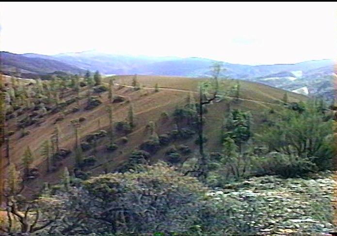
both sides of the valley. Base elevation is about 2200 feet and trails
top out well over 4000 feet on either side. On a mid-January visit, the
highest peaks had a dusting of fresh snow. Vegetation runs from oaks
and pines down low, to madrone and brush up higher. Some hillsides are
nearly bare of plants, probably due to different mineralogy. It is
quite spectacular scenery and there are numerous abandoned and working
mercury, asbestos and gemstone mines.
As
the name implies, the area is located in the Clear Creek drainage on
Clear Creek Road. The road is accessible by fording the San Benito
River (you've got diff breathers, right?) from the Coalinga - Los Gatos
Road which connects the town of Coalinga to the south and Hwy. 25 to
the north. Its about 56 miles south of Hollister and 35 north of
Coalinga. The area extends about 12 miles up stream, with trails on
both sides of the valley. Base elevation is about 2200 feet and trails
top out well over 4000 feet on either side. On a mid-January visit, the
highest peaks had a dusting of fresh snow. Vegetation runs from oaks
and pines down low, to madrone and brush up higher. Some hillsides are
nearly bare of plants, probably due to different mineralogy. It is
quite spectacular scenery and there are numerous abandoned and working
mercury, asbestos and gemstone mines.
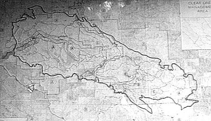 I
found there were no trail maps available on my first visit, other than
a faded topo map posted at one of the trailheads. I contacted the BLM
in Hollister and they sent me copy of the trail map (I'd recommend you
do the same). The county road (gravel) enters from the far left edge of
the map (above), following Clear Creek upstream to the right and
downwards. I'll try to describe the trails I visited in the order they
are encountered traveling upstream.
I
found there were no trail maps available on my first visit, other than
a faded topo map posted at one of the trailheads. I contacted the BLM
in Hollister and they sent me copy of the trail map (I'd recommend you
do the same). The county road (gravel) enters from the far left edge of
the map (above), following Clear Creek upstream to the right and
downwards. I'll try to describe the trails I visited in the order they
are encountered traveling upstream.
| Name | Begins | Ends | Length (miles) | Rating |
| Molina Ghost Run | Oak Flat Campground | New Idria town site | 10 | Difficult? |
| North Ridge Road | Second Campground | ? | 10 | Moderate? |
| Jade Mill Road | Second Campground | North Quicksilver Hill | 3 | Moderate? |
| Trail One | Staging Area One | ? | ? | Difficult |
| Slim's Trail | Staging Area One | ? | ? | Moderate |
| Handlebar Hill | Staging Area Two | ? | ? | Easiest |
| Quicksilver Hill | Staging Area Two | ? | ? | Easiest |
| North Quicksilver Hill | Staging Area Two | Jade Mill/Country Road intersection | 1.5 | Moderate |
There are no fees to enter this area and correspondingly, there are almost no facilities.
![]()
If anyone has a Ghost Run trip report they would like to submit, I'll gladly post anything you send me.
![]()
After a wonderful weekend in Panamint and Death Valleys and with a winter storm headed towards the Sierras, I decided to head home Sunday evening via Bakersfield and I-5 along with Tim and Bob Stucky. We parted company when they turned north on Hwy. 99, and after gassing up I headed north on I-5. I was getting tired around midnight, so a quick look at the maps showed I could cut over towards Coalinga where I pulled over for the rest of the night. At daybreak, I wandered through town and the oil fields to the west and finally found Los Gatos Creek Road. It had been raining and there were numerous places where water was flowing over the road.
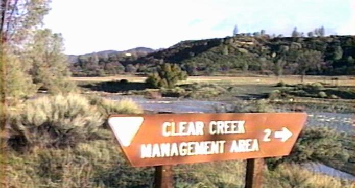 After
about an hour of driving out of Coalinga, I came across the sign to the
Clear Creek Management Area. You need to ford the San Benito River
(visible just over the top of the sign), which was flowing about hub
deep with the recent rains. After a few miles on the gravel county
road, you hit Oak Flat Campground. If I had thought to bring some
information, I would have known this is the start of the Molina Ghost
Run, but since I saw no signs, I kept on going.
After
about an hour of driving out of Coalinga, I came across the sign to the
Clear Creek Management Area. You need to ford the San Benito River
(visible just over the top of the sign), which was flowing about hub
deep with the recent rains. After a few miles on the gravel county
road, you hit Oak Flat Campground. If I had thought to bring some
information, I would have known this is the start of the Molina Ghost
Run, but since I saw no signs, I kept on going.
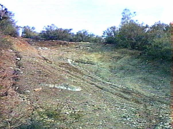
At a small, undeveloped campground, I saw the signs for North Ridge and Jade Mill roads. I aired down to 16 PSI and locked in the front hubs. I followed this road a ways up the hill, until I ran into a homestead and I turned around.
 Further
up the road I hit the OHV Staging Area One parking lot. There was a
wicked looking hill climb to the north of the lot, so I tried it (its
rated Most Difficult - black diamond)). Severely rutted and covered in
greasy mud, I amazed myself at getting up as high as I did. Up to
30° incline, the truck just motored up. The wheels were spinning,
but still making headway. After passing a water break to the left, the
trail got a whole lot steeper and forward momentum stopped.
Further
up the road I hit the OHV Staging Area One parking lot. There was a
wicked looking hill climb to the north of the lot, so I tried it (its
rated Most Difficult - black diamond)). Severely rutted and covered in
greasy mud, I amazed myself at getting up as high as I did. Up to
30° incline, the truck just motored up. The wheels were spinning,
but still making headway. After passing a water break to the left, the
trail got a whole lot steeper and forward momentum stopped.
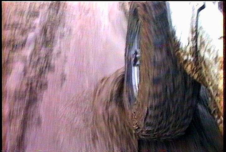
 This
was 35°+, and even with parking brake and low gear, the truck just
barely would stay put. I got out to survey the trail and decided that I
didn't want to back all the way down. So the best bet was to back down
to the water break and do a three point turn there. I got onto the
diagonal break, then got the front end up and over the berm, pointing
about 45°down slope. The side slope was up around 20° and was
feeling a bit tippy with the right front dropping away. I got out and
looked some more. It looked like I would go beyond the static limit of
rolling (if I stopped) but if I made the rest of the drop in a
continuous motion, I'd be pointed straight downhill before rolling.
Taking a deep breath, I let the clutch out, all four M/Ts began clawing
at the mud and over I went. It was a few seconds before I could see the
road over the hood and it worked, I was turned and the greasy side was
still down!
This
was 35°+, and even with parking brake and low gear, the truck just
barely would stay put. I got out to survey the trail and decided that I
didn't want to back all the way down. So the best bet was to back down
to the water break and do a three point turn there. I got onto the
diagonal break, then got the front end up and over the berm, pointing
about 45°down slope. The side slope was up around 20° and was
feeling a bit tippy with the right front dropping away. I got out and
looked some more. It looked like I would go beyond the static limit of
rolling (if I stopped) but if I made the rest of the drop in a
continuous motion, I'd be pointed straight downhill before rolling.
Taking a deep breath, I let the clutch out, all four M/Ts began clawing
at the mud and over I went. It was a few seconds before I could see the
road over the hood and it worked, I was turned and the greasy side was
still down!
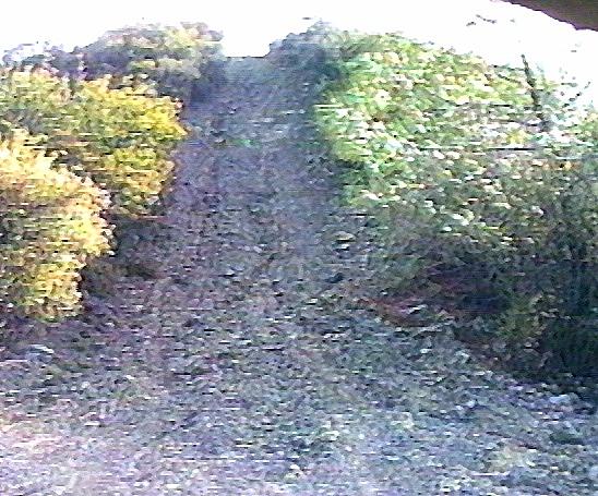
So, after catching my breath, I decided to stick to green and blue runs, due to the mud. To the south, across Clear Creek, was a blue run, called Slim's Trail. In the shade of the north slope, it was even greasier, and I ended up in the same boat. Stuck on the steep section just feet from the crest. Once again, I backed into a water break and got turned around.
 Further
up the county road, is Staging Area Two. Two green tails led off to the
south, I tried Handlebar Hill, because it looked rockier, figuring I'd
have better traction there. Around the first corner, the rocks ended
and I proceeded up the muddy road. Once again, feet from the top,
forward progress ground to a halt and I had to back down to a flat area
and turn around. Gosh, three strikes, I was about ready to call it
quits.
Further
up the county road, is Staging Area Two. Two green tails led off to the
south, I tried Handlebar Hill, because it looked rockier, figuring I'd
have better traction there. Around the first corner, the rocks ended
and I proceeded up the muddy road. Once again, feet from the top,
forward progress ground to a halt and I had to back down to a flat area
and turn around. Gosh, three strikes, I was about ready to call it
quits.
 I
decided to give it one more try and saw the North Quicksilver Hill
trail to the north. Figuring that the south-facing slope would be
somewhat drier, I headed up this blue run. After a few steep spots and
ruts, including one off-camber section where the rear Detroit locker
caused the rear end to swing downhill, while the TrueTrac up front held
the slope nicely.
I
decided to give it one more try and saw the North Quicksilver Hill
trail to the north. Figuring that the south-facing slope would be
somewhat drier, I headed up this blue run. After a few steep spots and
ruts, including one off-camber section where the rear Detroit locker
caused the rear end to swing downhill, while the TrueTrac up front held
the slope nicely.
 I
finally got up onto the ridge and a trail junction, indicating I'd come
1.5 miles. I took the fork that went on towards the barren ridge to the
east, but the trail was very narrow and looked to be getting narrower
fast, so I backed down and took the Jade Mill fork (I'd seen the other
end earlier) so at least I figured I knew where I was going (no maps,
etc.). The road follows a fence line down the ridge. I checked out each
downhill section carefully, since I just might have to climb it if the
road petered out.
I
finally got up onto the ridge and a trail junction, indicating I'd come
1.5 miles. I took the fork that went on towards the barren ridge to the
east, but the trail was very narrow and looked to be getting narrower
fast, so I backed down and took the Jade Mill fork (I'd seen the other
end earlier) so at least I figured I knew where I was going (no maps,
etc.). The road follows a fence line down the ridge. I checked out each
downhill section carefully, since I just might have to climb it if the
road petered out.
 After
one steep downhill section, I found a nice little undeveloped ridgetop
campsite. Also saw some fresh truck tracks, so the route must go on.
Finally the road started to drop off the ridge along a badly rutted
road. With the slippery mud, it was often not possible to straddle the
ruts. Once I got stuck in one that wanted to take me off the edge of
the road. I had my left front hanging in the air, but the right front
had enough traction to pull me out and back onto the road. Hit one
tight turn that required some maneuvering to negotiate and then came
out on the other side of the homestead I had first seen, about 3 miles
from the junction on the ridge.
After
one steep downhill section, I found a nice little undeveloped ridgetop
campsite. Also saw some fresh truck tracks, so the route must go on.
Finally the road started to drop off the ridge along a badly rutted
road. With the slippery mud, it was often not possible to straddle the
ruts. Once I got stuck in one that wanted to take me off the edge of
the road. I had my left front hanging in the air, but the right front
had enough traction to pull me out and back onto the road. Hit one
tight turn that required some maneuvering to negotiate and then came
out on the other side of the homestead I had first seen, about 3 miles
from the junction on the ridge.
 I
got back to the county road and headed back to the main road. After
airing up, I took a few slow passes across the river to wash off as
much gunk as I could the headed north towards Hwy. 25, near the
Pinnacle National Monument turnoff.
I
got back to the county road and headed back to the main road. After
airing up, I took a few slow passes across the river to wash off as
much gunk as I could the headed north towards Hwy. 25, near the
Pinnacle National Monument turnoff.
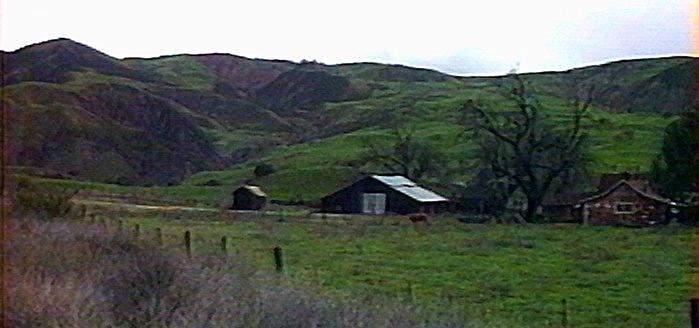 The
fields were so green with the winter rains. Gassed up in Hollister and
hit a real cloudburst before reaching Hwy. 101. Between the river and
rain, most of the mud was gone when I got home. Went through $3 of
quarters at the local car wash to get the rest of it.
The
fields were so green with the winter rains. Gassed up in Hollister and
hit a real cloudburst before reaching Hwy. 101. Between the river and
rain, most of the mud was gone when I got home. Went through $3 of
quarters at the local car wash to get the rest of it.
![]()
Here are some links to other sites with more information on this area:
![]()
![]()
 ===>>
===>>