![]()
![]()
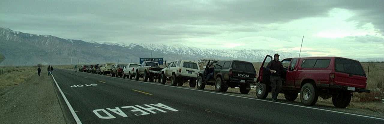
For the eighth year running, a group of 20 4x4's, led by our fearless leader Terry, met near Ridgecrest, CA. early on the morning of February, 17, 2001 in preparation for two days of off-road adventure in Panamint and Saline Valleys. Rumor has it that the 9th Annual Death Valley trip will take place on President's Weekend (Feb. 2002). Stay tuned to this Bat Channel for more details later this year.
![]()
I had planned to arrive a day early and spend some time exploring the area around Ridgecrest and Trona before heading out to the Trona Pinnacles National Historical Landmark, about 25 minutes northeast of Ridgecrest. They were shooting a new Planet of the Apes movie out there,, so parts of the area were blocked off. Anyway, I was still working on installing my new front axle and was not happy with the front brakes, so ended up spending the "extra" day working on the truck. It was later on Friday when I finally left and I ended up arriving in Ridgecrest around 11PM and didn't see any handy gas stations open. So instead of driving clear out to the Pinnacles and then back in the morning, I found a nice camping spot in the Spangler OHV area outside Ridgecrest.
I was able to hook up with the main group in the morning for the driver's meeting. We picked up one additional rig at the Pinnacles turnoff and then headed on to the turnoff for Fish Canyon. There, I led a small group of 4 vehicles to Panamint Valley via the Fish Canyon road, while the rest of the group went via pavement to Ballarat and ultimately to the South Park Canyon turnoff north of the Briggs Gold Mine.
Originally, we intended to "play" around in Fish Canyon, but decided to press on and re-join the main group.
![]()
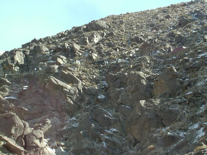
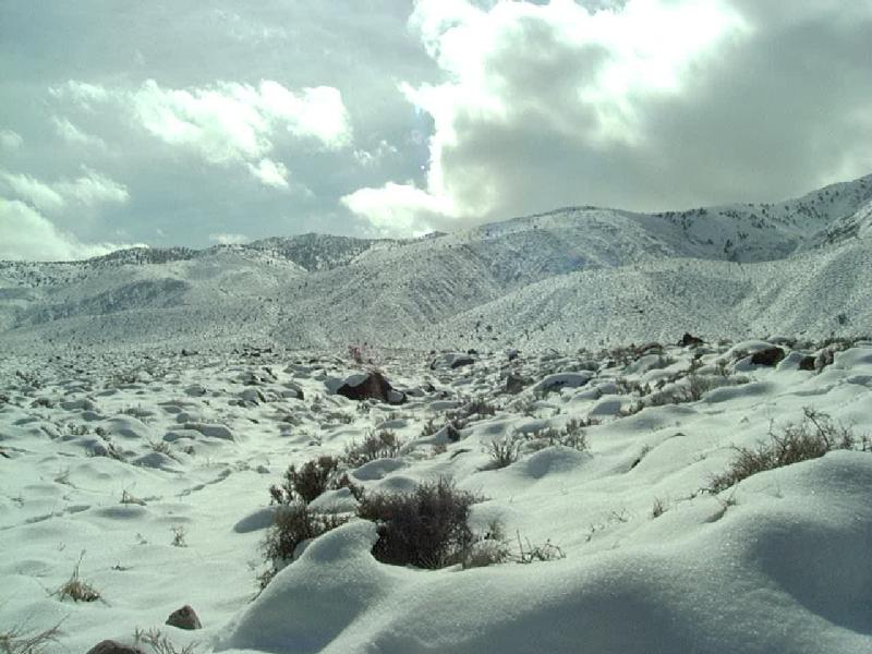
Our first trail was going to be the South Park Canyon - Pleasant Canyon loop. This is a 30 mile trip that starts at 1200' in elevation at Ballarat and rises to 7100' at the top of Roger's Pass. Apparently, in past years the trail was mild enough to get through the majority of the trail in 2WD. This year, it wasn't the trail so much as the elevation that got us. A week before, a major snow storm had hit the entire area, with snow levels at 2500 feet or so. By the time we arrived, snow levels had retreated to about 5-6000', but in the shady spots, snow was 2-3' deep and untracked.
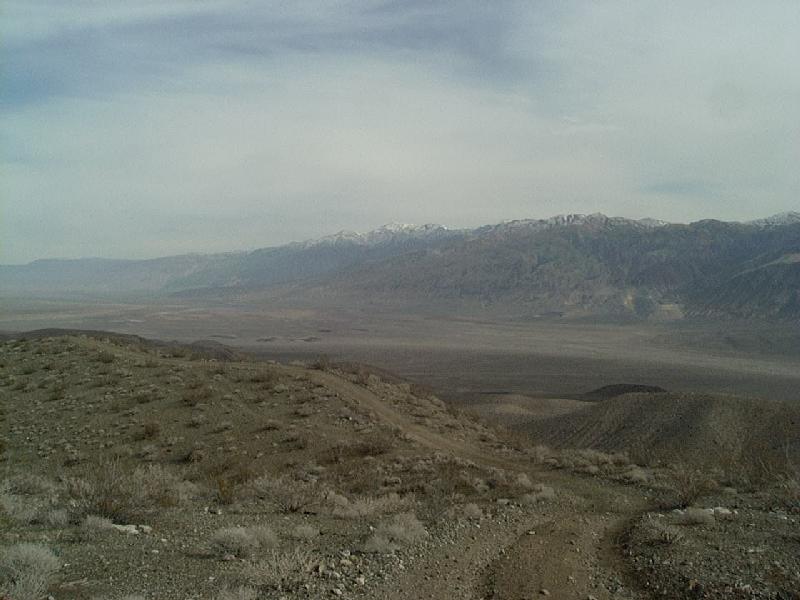
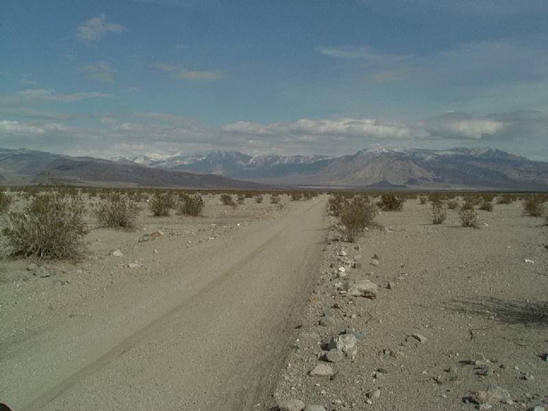
Anyway, out small group of four trucks had rounded the south end of Panamint Valley then passed the Brigg's Gold Mine before turning off on the South Park Canyon road. The road climbs steeply up the valley walls for quite a ways before it drops into South Park Canyon proper. The last turn before dropping into the narrow canyon offers a stunning view of Panamint Valley, with evidence of recent precipitation and the snow-capped Argus Range in the distance.
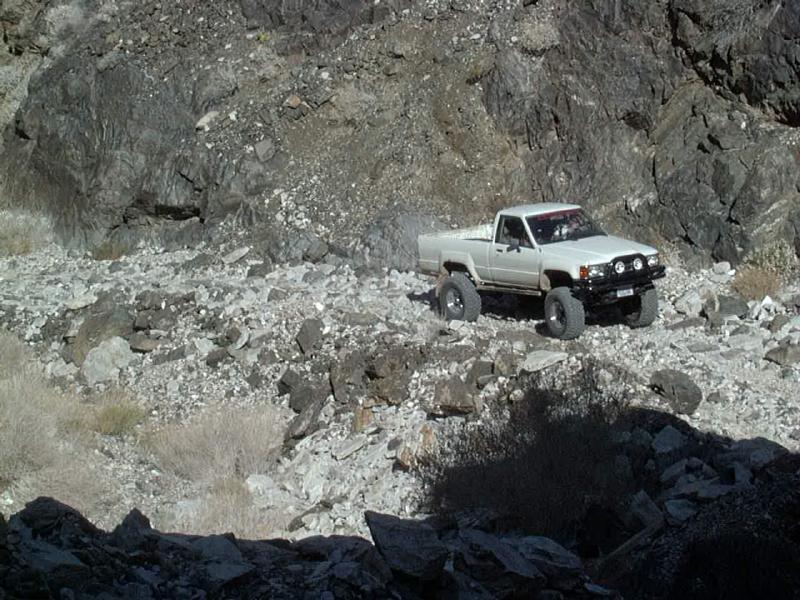
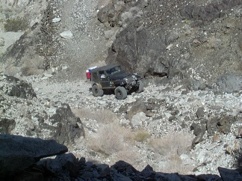
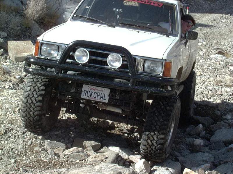
Once in the canyon, the road narrows and in a mile or so you reach a section that had washed out at one time. The new road is a rocky climb that used to be a lot harder but has become fairly smooth and filled in. 4WD is required here due to the loose rocks and sand. To the left, Tim climbs the grade in his pickup as does Andrew in his Jeep. Oh, and if you have anything larger than a Jeep CJ2 or Suzuki Samurai, don't even think about taking the "easy" old road. Its washed out at the top right where the cliff juts out and there is no way to get by, as Randy demonstrates :-)
In about another mile, we arrived at the Brigg's Cabins at the base of the big waterfall in the canyon, Up at the top, we saw the rest of the group, you can just make out some of the rigs lined up on the narrow shelf road, above. Apparently, Don was testing out his new front locker and found that it did work!
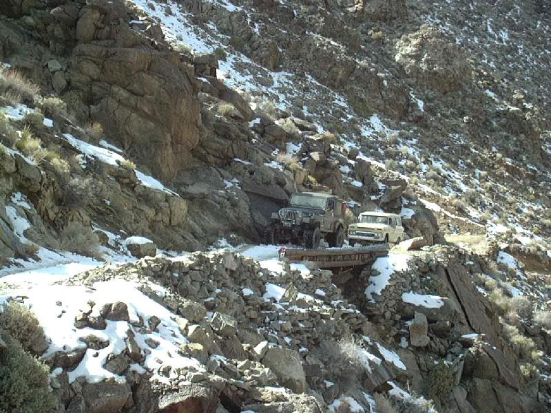
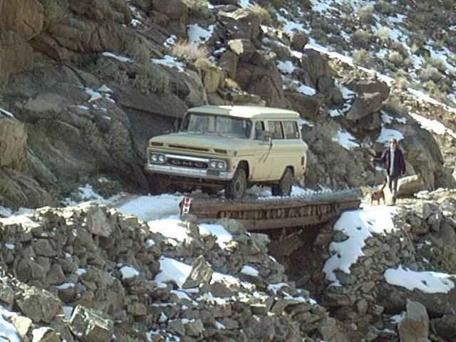
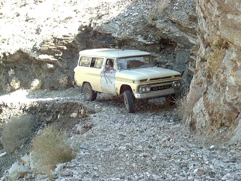
Starting up the hill, you come to the infamous log bridge. According to the sing, its rated at 3 tons, Andrew crossed it with ease, but Randy's '65 Suburban was pushing the envelope a bit. But he made it over without trouble, 2- and 4-legged passengers following behind.
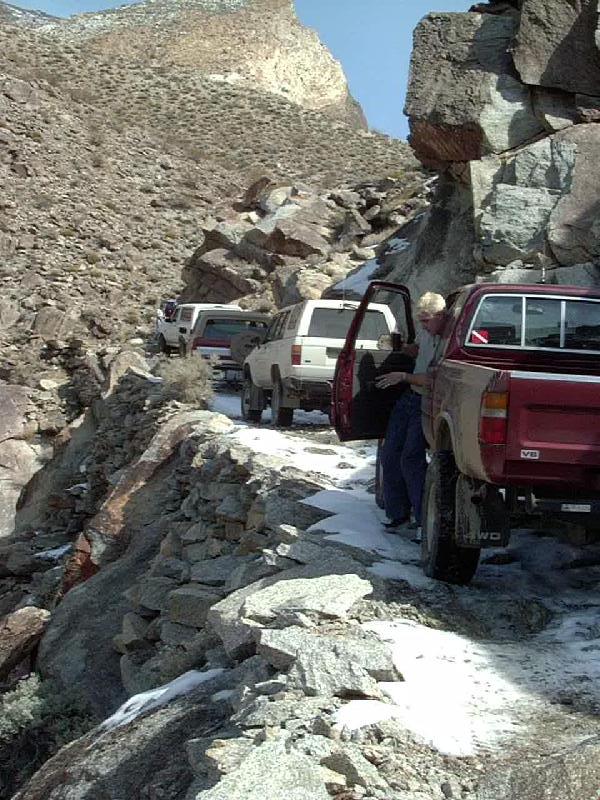
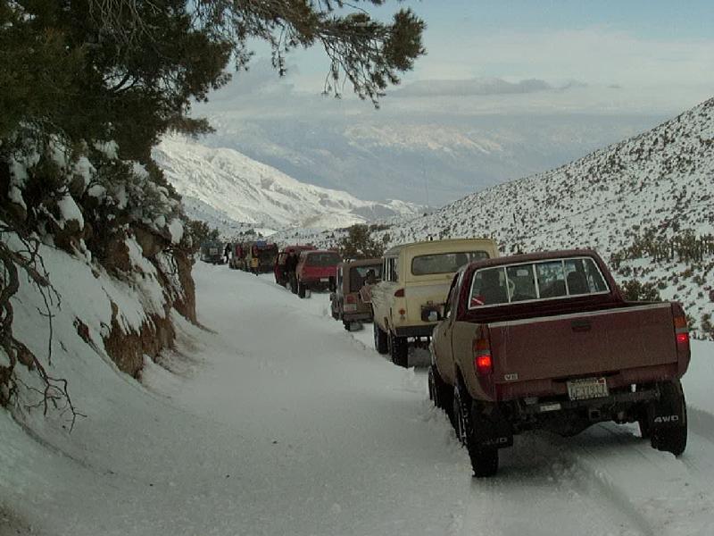
We quickly climbed the steep hill, with some ice and snow in the shady sections and caught up with the group. Here, trucks are lined up waiting to negotiate the tight turn I call "Chicken Rock" mainly for the "chicken-wire" reinforcing mesh that is used to hold the rock fill together on the outside of the turn. The turn used to be fairly wide, but erosion has taken a good sized section of the trail away. On this section of the trail, the key is to hug the outside edge. This is especially true at Chicken Rock as the road cut is decidedly off-camber towards the inside. If you chicken out and try to hug the wall, you'll tip further to the outside drop-off.
Above the waterfall, the canyon opens up for a bit. There's a washed out stretch, with a few rocks to climb over. A bit of a challenge for open-diff vehicles, a piece of cake for locked rigs.
As we climbed in elevation, the snow deepened. It was also deeper on the shady side of the canyon, one steep stretch had some pretty icy snow on it, By the time the last two rigs came up, it was very slippery. Andrew had a bit of trouble getting up one stretch but finally made it up, followed by Randy in the 'burb. He stopped at one point and the front end slid to the downhill edge of the narrow road. If he tried to go forward or back, the vehicle just inched closer to the edge of a 5' deep drop off that was full of snow. Andrew went ahead until he found a spot to pull off, then I turned around and went back to attach a winch cable. In the narrow canyon, there was no way to get any good anchor and the icy road offered little traction, so I nosed my front end up into the canyon wall on the uphill side, then pulled the cable over and hooked it to the downhill tow hook. I started winching as Randy tried to drive forward, but gravity kept wanting the truck to go over the edge. With no other choice at hand, we kept going until it did slide off the bank into the ditch. Then, with the driver's side in the ditch and passenger side barely touching the ground, I was able to winch the 'burb back up onto level ground.
In the mean time, Terry had run into a long, steep hill around the corner where the 18" deep, untracked snow proved to be too much. So after stopping for a lunch break, we turned around and headed down the way we came in, letting everyone experience Chicken Rock in the even more interesting downhill direction!!!
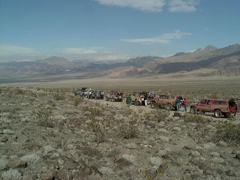
After reaching the valley floor, we headed north and west ending up at Lone Pine just after sunset. Everyone found rooms for the night and after dinner, we all hit the sack and wondered what tomorrow would bring?
Sunday morning we gathered in Lone Pine...
...before heading east to the Saline Valley turnoff, where we found a half foot of snow on the ground at 5200'. At the turnoff was a handwritten sign warning folks to stay off the road because of deep snow and Inyo County had a large "Road Closed" sign.
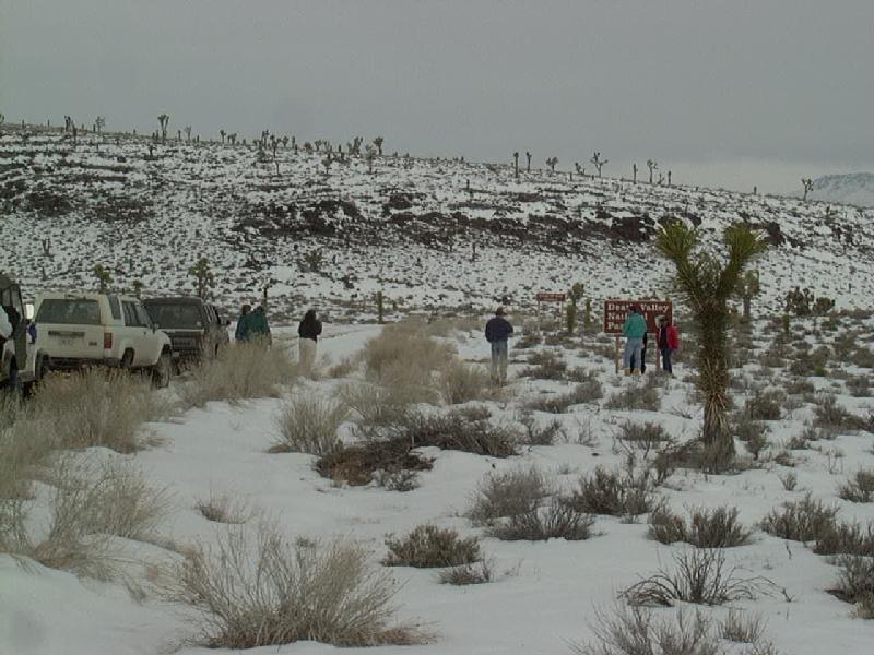
We had to get out and check the sign to be sure we were in the right place. Sign said Death Valley National Park, snow said Lake Tahoe, except for that darn Joshua Tree! After airing down and locking hubs, we headed up the road towards South Pass.
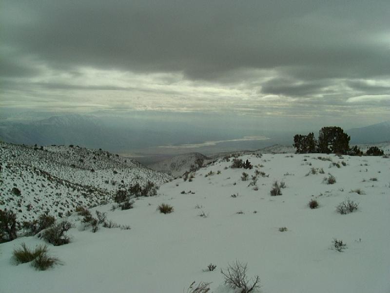
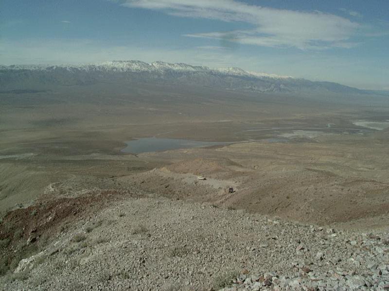
On the way, was an interesting view down into Panamint Valley. We soon passed a group of campers who told us the road was blocked by an abandoned vehicle and that there was no way we could get by.
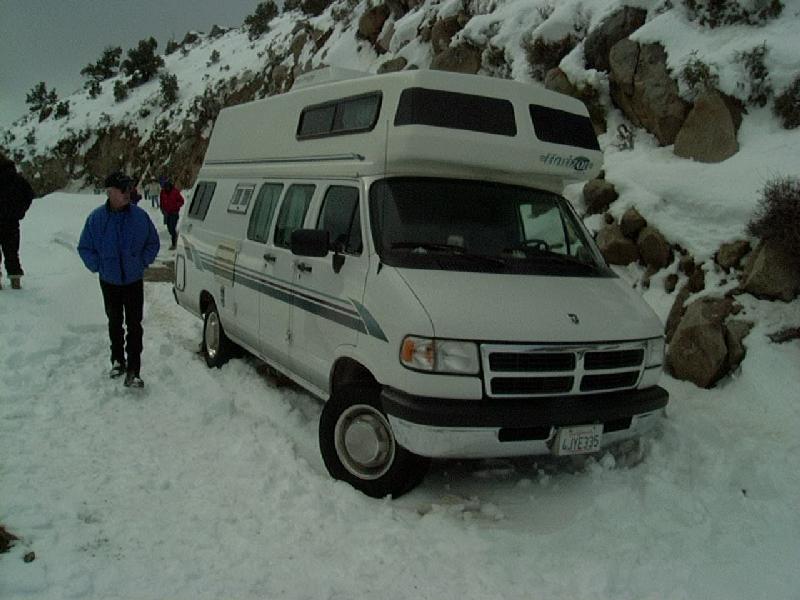
A few miles later we encountered the vehicle, a 2WD Dodge van/camper stuck smack-dab in the middle of the road. This guy had tried driving up the road the week before, apparently in the middle of the snow storm. He got up to the high point on the road and began dropping down, got to this narrow spot and got stuck. He could not back up or turn around and ended up stranded in the camper from Sunday to Thursday, when he apparently hiked out to the main road, got a ride into town. Anyway, when we got there, here was this huge camper blocking the narrow road. It looked like we could squeeze by on the outside and soon had all our rigs by.
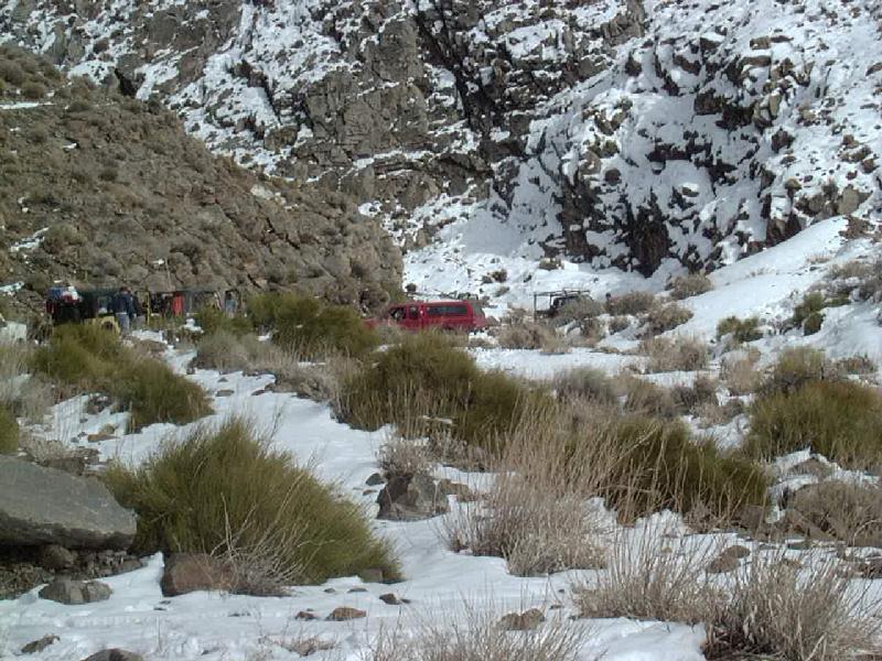
As we passed around to the south facing slopes, the snow got fairly deep. 3-4' drifts in spots slowed us for a while, but Terry aired his tires down and was able to break through the untracked snow. After a mile or so, so encountered footprints coming up the road and after another few miles, ran into tire tracks. Apparently someone from the valley had been up surveying the road conditions and had turned back. Gradually, the snow turned to slush, the slush to mud and finally we emerged one of the cold and wind near Hunter Mountain into the warm sun in Saline Valley.
Look to the south and this is what you see, turn and look north and its a totally different view!
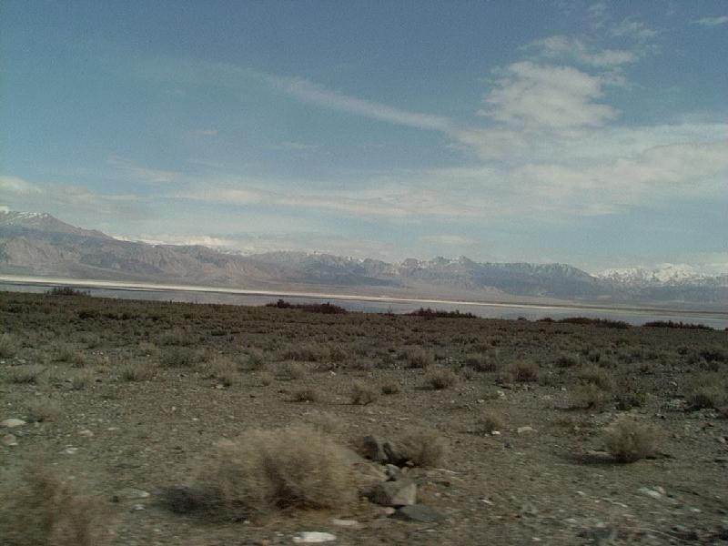
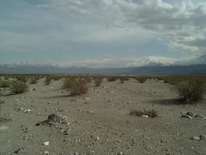
As we passed the normally dry lake bed in Saline Valley, you could see the reflection of the mountains to the east in the water.
We made our way up west side of the valley, reaching the turnoff to the hot springs. After regrouping, we headed east towards the springs and hopefully continuing on over Steele Pass to Eureka Valley and ultimately Big Pine. When we reached the springs, we were greeted by a huge group of stranded campers. Shouts of "South Pass is open" were heard as the word got out. We talked with one guy who had been about 5 miles up towards the pass, the road was OK, but apparently there was some snow at the pass and nobody had been through since the recent storms.
As there was a bit over an hour of daylight, it was decided that we take the certain route back out the way we came in. So we got turned around and headed back towards South Pass. Along the way, we picked up at least one of the campers who decided to follow us out. Folks had been essentially stranded in the valley for a week by the snow. The Lippencott Grade was open, and we saw one large pickup that came down the grade, but its a long way to anywhere via that route.
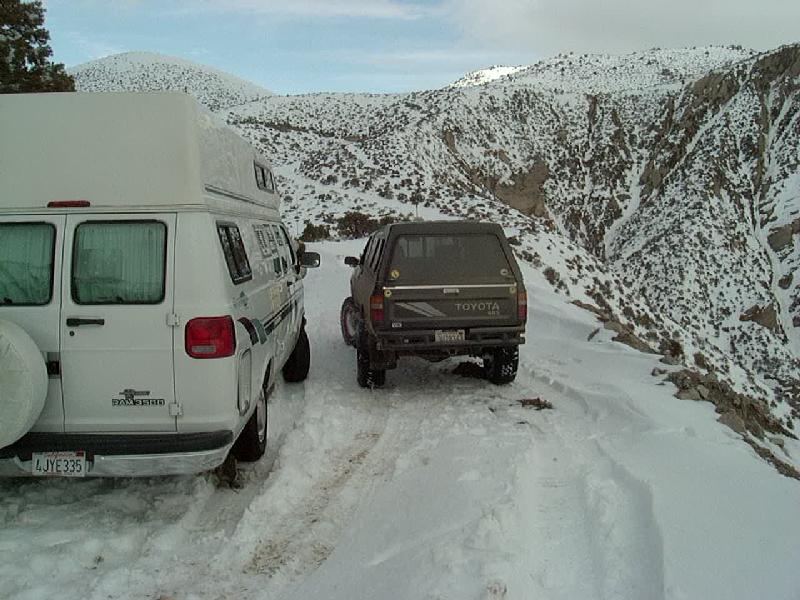
So, with darkness approaching, we headed back up Grapevine Canyon towards South Pass. It was a bit harder going uphill in the slippery snow, now beginning to ice up in the cold. But we were making good time, until we got to the steepest, narrowest section of the road, when who do we meet, but the bozo in the camper coming down the hill! Seems he had rented a Jeep Cherokee in town, bought a set of chains for the camper and was now attempting to drive the huge 2WD camper down a steep, unplowed road, in the dark, by himself! After a lot of work, we were able to dig out a wide enough spot on the road, to get the camper and Jeep off to the side. Then we were able to squeeze by on the inside, just barely. In fact more than a few vehicles slide in the nice shiny rental Jeep in the slippery snow. I think the full sized Suburban did the lost body work. Apparently the guy in the camper was convinced to stay where he was for the night and then try continuing in the daylight.
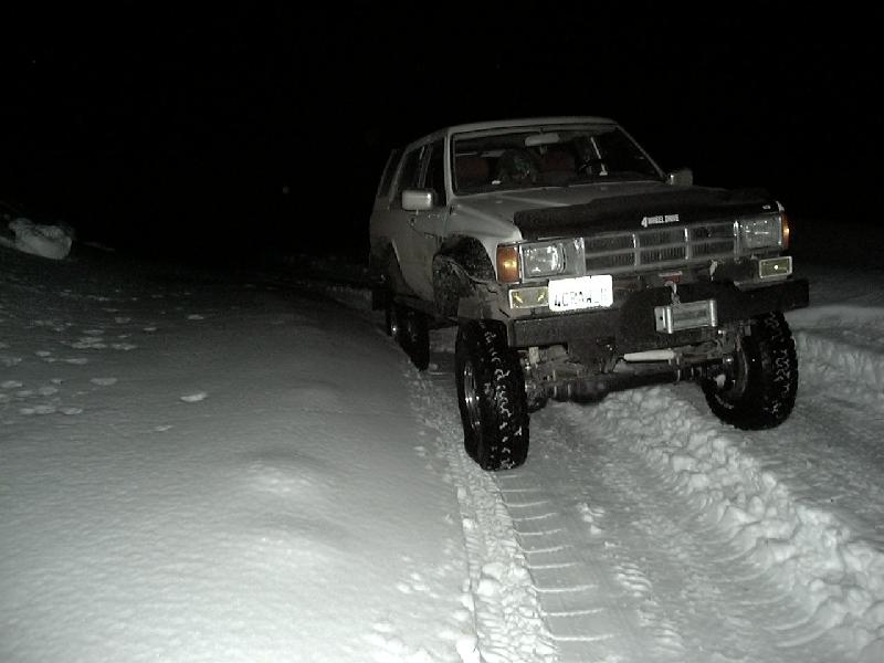
Anyway, it was pitch black when we got to the top. We had about 10 rigs in the lead group and we lost contact with the others. I turned around and went back down the road until I lost radio contact with the lead group, but then could hear the rest of the group on the radio, just as they got the last rig around the camper. Soon, I saw headlights coming up the hill. This was the first wheeling trip on my new BFG AllTerrain/KO tires, 33x10.50 mounted on 15x6 rims. All I can say about those tires is WOW! In the photo about, I was aired down to 10 psi, my old 33x9.50 MTs never worked well below about 15 psi, although I did have them to 6 psi in some deep snow, but they were almost undriveable. The ATs at 10 would float up on top of the unpacked snow off the road, I had to turn around twice and all I had to do was drive up on top of the snow to the side of the road. On the hard packed, icy snow in the photo, the tires grabbed like they had chains on. There were road sections that walking was treacherous, yet these tires just crawled right up without even slipping. Smooth and quiet on the road, about the only complaint is that the tighter AT tread picks up gravel and throws it all over. Time to get those front mud flaps put back on!
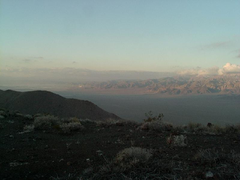
After reaching the highway, safe and sound, we all aired up and most of the group headed back to either Lone Pine or Big Pine. I opted to head back east into Panamint Valley and ended up in the north end of Searles Valley for the night. I wanted to explore the roads out east of Trona and took a small BLM road off of CA-190, it ultimately hooked up with a fairly well graded road (Quarry Road as it turned out) that forked at (you guessed it) the quarry! I took the right fork away from the quarry and started climbing, until I found a good camping spot.
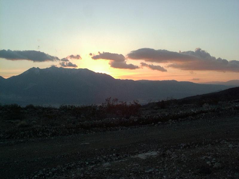
The next morning, a bit before sunset I continued up the the ridgeline and caught the sun just rising over the Panamint Range.
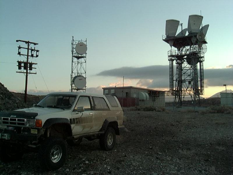
Continuing up the road, there are a number of microwave, radio and radar towers at various points. This site, is apparently relays signals from the radar dish near Ballarat and over to China Lake NWC. According to the BLM map I had, there are a series of roads that all connect up along the ridge and end up at Fish Canyon. Apparently this road is not the one, or the maps are incorrect. I guess it's time I get a GPS and go back and find out for sure!
Other sites have microwave relay towers and all of them have spectacular views. Here in the distance is the processing plant at Trona.
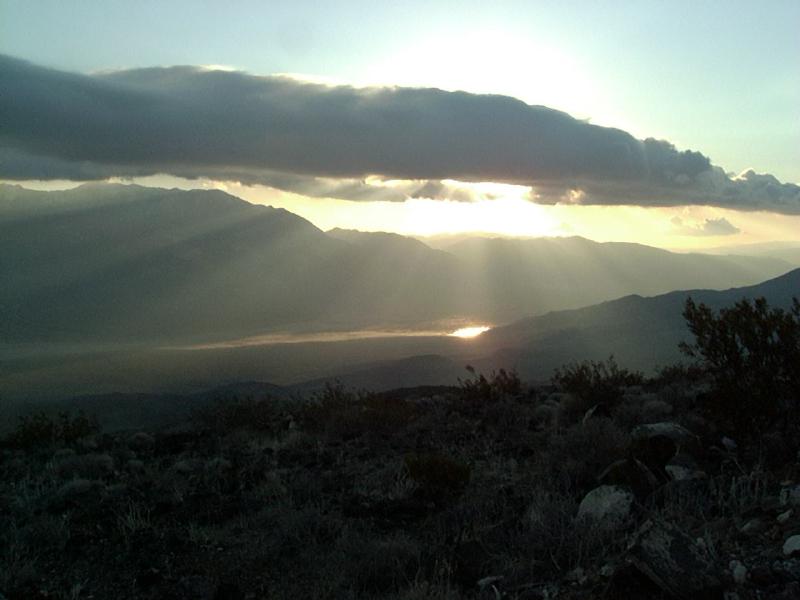
On the way back down, the sun got behind clouds and made this stunning display over the lake in Panamint Valley.
![]()
Visitor # 14890 since 14.NOV.2004
[Initial Creation: 28.FEB.2001] [Last updated: 25.July.2021]
![]()